Rising concerns: The science behind Cape Girardeau’s repeate. . .
(Editor's note: This is the third in a series on water issues in and around Cape Girardeau. )Southeast MissourianCape Girardeau’s history is awash with stories of flooding. In1922, a Frisco Railroad train. . .
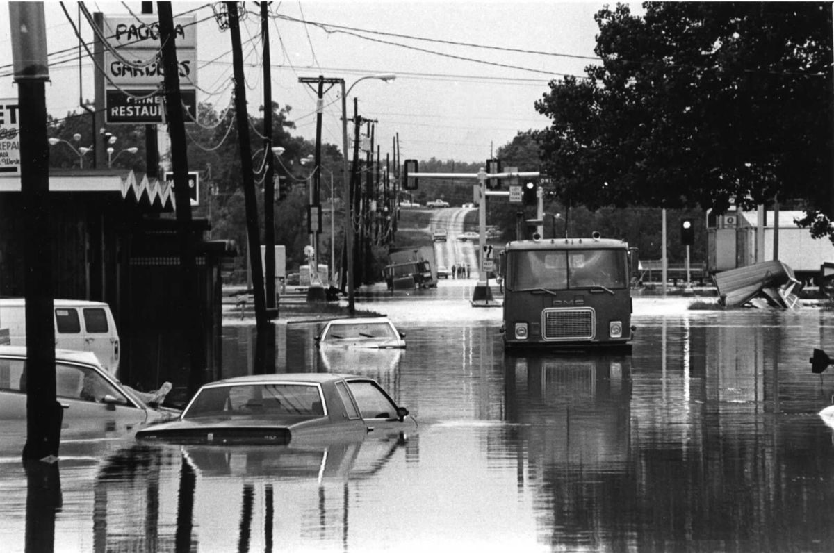
(Editor's note: This is the third in a series on water issues in and around Cape Girardeau. )Southeast MissourianCape Girardeau’s history is awash with stories of flooding. In1922, a Frisco Railroad train sloshed through a foot of floodwater, and farm fields just south of town were blanketed in 4 inches of water for days,wrote former Southeast Missourian history columnist Garret Wright. In1944,a photographer captured an imageof a boat, not meandering across a pond, but rowing through the city’s flooded Main Street. In more recent memory, theGreat Flood of 1993brought widespread devastation, ravaging Missouri alongside several Midwest states, killing dozens and leaving behind billions of dollars in damage. And in2016, the Mississippi River reached a historic crest of nearly 49 feet in Cape Girardeau, breaking the Great Flood’s record by just a few inches. Flash floods —the most dangerous type of flooding— have also saturated the city’s history. In1986, 6. 64 inches of rain fell on Cape Girardeau over the course of 24 hours. Water inundated houses and businesses, and two local residents drowned trying to make their way home. In hisstorymarking the 1986 flash flood’s 25th anniversary, then-Southeast Missourian reporter Scott Moyers wrote, “If flooding caused by the rise of the river is like a cumbersome bully that announces his intention to torment, then flash floods are the dizzying sucker punch. ”Today, Cape Girardeau is still feeling its share of sucker punches. This summer, the city waded through its second wettest June on record, with two flash floods bookending the month. Both days, June 8 and June 26, broke their daily precipitation records, according to the National Weather Service. As Cape Girardeau — and communities nationwide — continue to grapple with extreme weather events, experts anticipate we’ll experience them more often in the future. What we consider atypical now may be more commonplace in the years to come. In other words, Mother Nature isn’t pulling her punches. Ingredients for a flash floodFlash floods are unpredictable, and they can quickly overwhelm storm drainage systems, roadways and vehicles. But what causes a flash flood in one place may not cause it in another. “There’s not one ingredient list that always produces flash flooding,” said NWS-St. Louis meteorologist Brian Haines. Several factors can come together to trigger a flash flood. Excessive rainfall in a short period of time. A slow-moving thunderstorm, or storms that hit the same area over and over again. Soil that can’t absorb any more water. Steep terrain funneling water to areas downhill. These variables can all push an area closer to a flash flood warning. NWS receives its flash flood guidance from its River Forecast Centers. This guidance tells forecasters how much rain it would take in a certain time span to cause flash flooding. For Cape Girardeau, NWS-Paducah senior forecaster Keith Cooley said “flash flood guidance doesn’t really change a lot. ” Why?All that concrete — another key factor when it comes to flash flooding. “When (rain) falls on concrete and buildings and things like that, it just all runs off quickly,” Cooley said. “So, that's why the flooding gets kind of exacerbated there in the city. ”Like other more urban areas, the buildings and roads that sprawl across Cape Girardeau help keep the rain threshold for a potential flash flood relatively low. Around this time of year, about 1 ½ to 2 inches of rain in an hour, or 2 to 2 ½ inches of rain in three hours, can generally cause a flash flood, Cooley said. Both the June 8 and June 26 storms cleared that threshold, according to NWS radar estimates. But beyond the radar, June storms left behind an estimated $4 million in damage at Cape Girardeau’s police station. They also nearly claimed lives along Kingshighway, where people were pulled from their vehicles to escape the flash flood waters,according to previous reporting in this series. In the aftermath, officials are assessing the current flood controls on Kingshighway to develop recommendations for improvement,per previous reporting. Participating entities are set to exchange their findings early next month. Heating upAnother consideration when it comes to flash flooding? Heat. “Generally, warmer air can hold more water vapor, and it also increases the evaporation rate as well,” Missouri state climatologist Zack Leasor said. “So really, warmer temperatures just provide a lot more fuel for these storms as far as precipitation, which can result in these heavier rainfall rates and then more flooding issues. ”Summer is usually prime time for flash flooding, Haines noted. Alongside the effects of higher temperatures, lower wind shear can allow summer storms to sit over the same area. “In any normal year, you would expect more flash flooding to occur in June, July, August, generally, than you would in another time of season,” he said. “That’s not always the case, but when you average everything up over a long period of time, this is our flash flood season. ”Temperatures in Missouri are getting warmer, though, Leasor said. Cape Girardeau County’s average annual temperatures have gotten about 2. 6 degrees warmer over the past 50 years, and average summer temperatures have gotten about 1. 2 degrees warmer over the same time period, according to data from the National Centers for Environmental Information. Missouri has experienced a relatively small increase in overall annual precipitation, but extreme rainfall events are showing a more significant uptick, Leasor said. That trend, he noted, is influenced by rising temperatures. “We’ve done some research here in the state of Missouri previously that shows that the number of greater-than-3-inch 24-hour rainfall events — which, you get 3 inches in a day, it’s usually going to cause some flash flooding issues — has really notably increased across the state, particularly over the past 30 years,” Leasor said. “That is something we’ve seen, and then we expect to increase in the future as well. ”While more research likely needs to be done on what exactly forms individual weather events, Leasor said we can still recognize how these extreme flash floods line up with what we know about climate change. “We can also, for now, look at an event like this and say, ‘This is very characteristic of what we’ve seen with climate change,’” Leasor said. Future forecastIn Cape Girardeau County’sonline floodplain information, there’s an important distinction: “Whether it was intended or not, labeling floods and storms as either a 10 or 100, or 500 year event has misled people into thinking that size flood event occurs once every 10 or 100 or 500 year time period. This is wrong. ”Indeed, a “100-year” storm isn’t a measure of time — it’s a measure of odds. If a 100-year storm rolls through town, it means there was a 1% chance of it occurring in any given year. “It doesn’t mean that it’s going to be 100 years before you get it,” Cooley said. “You could technically get it the very next day. ”Cape Girardeau’s June flash flooding events were considered “20-year” and “12-year” storms by the NWS, while city officials called them “100-year” floods using different rainfall charts. No matter how you slice it, those are long odds. But as climate data changes, those odds could be changing, too. Neil Fox, a University of Missouri professor and researcher with expertise in atmosphere and climate, said the way we label a weather event is based on past data. With that in mind, “it’s not clear” whether extreme weather events are actually as rare as their labels indicate anymore, he said. “The predictions seem to be that we'll expect more of these kind of events as things warm,” Fox said. “If everything’s warmer, we can expect more heavy rain events. So, whether a 1,000-year event is really still a 1,000-year event, I’m not sure if that’s accurate anymore. ”Leasor agrees. “Some of this is that, yes, we're seeing more extreme weather, so now we're seeing higher probabilities of seeing one-in-10 and one-in-20-year events, maybe even back to back,” Leasor said. “But the other part of it is that maybe the kind of methods we're using are not adapting fast enough to the actual climate, and so we're using outdated data to rate storms that are happening in 2026. ”With more extreme weather likely on the horizon, Leasor said “we can’t just rely on historical data” as we plan for the future. He suggested “thinking outside the box of historical normals,” taking climate projections into account and giving future infrastructure a “buffer” against evolving extremes. “Maybe from a building and design perspective, that’s going to be uncomfortable in the present, but I think it could help in the future for avoiding these floods,” Leasor said. Southeast Missourian reporters Bob Miller and Amity Shedd contributed to this report. Savvy Sleevar, a Southeast Missourian reporter based in Cape Girardeau, is also a corps member of Report for America, a national service program that matches local newsrooms with reporters who provide in-depth coverage of under-reported issues and communities. Report for America covers a portion of Savvy’s salary; the Southeast Missourian newsroom covers the rest. If you'd like to support her work and help sustain community journalism where it matters, please consider making a gift atwww. supportjournalism. com. Your donation will help underwrite Savvy’s reporting and empower local coverage that otherwise might go untold.